PublishedUbd, December 2021 |
ISBN9780731932566 |
FormatSoftcover, 1 pages |
Dimensions92cm × 69cm |
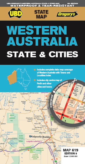
The latest edition of the Western Australia State and Cities map has been fully revised and updated.
It includes a comprehensive state map with an index to the towns and localities at a scale of 1: 2 900 000 plus more detailed coverage of South West Western Australia at a scale of 1 : 1 870 000 on one side.
On the other side there are street level maps for Perth city at a scale of 1 : 5 000, a Fremantle map at a scale of 1 : 15 : 000, and town maps for Mandurah, Busselton, Carnarvon, Broome, Albany, Geraldton, Esperance, Bunbury and Kalgoorlie-Boulder at a scale of 1 : 25 000.
There is also touring information included for the state.
With all this information contained in this handy fold out map it is an essential tool to keep by your side when travelling Western Australia.

