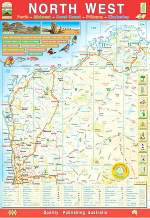
This handy, roughly A4 size map book covers the north west of Western Australia broken up over 12 pages. The front of the book has an overall map with the map page references shown which is useful for route planning. Road detail shown from major highways all the way down to unsealed roads, old tracks and 4WD only routes.
Also features useful and interesting places including various attractions, fuel stops, accomodation, campsites, rest stops and fishing spots. Elevation tinting shows the topography. Also included are average monthly temperature and rainfall charts for many areas. The maps are surrounded with illustrations of native flora and fauna. Also included various distance charts showing the distances between major towns in kilometres. Intermediate road distances are shown on nearly every road.